

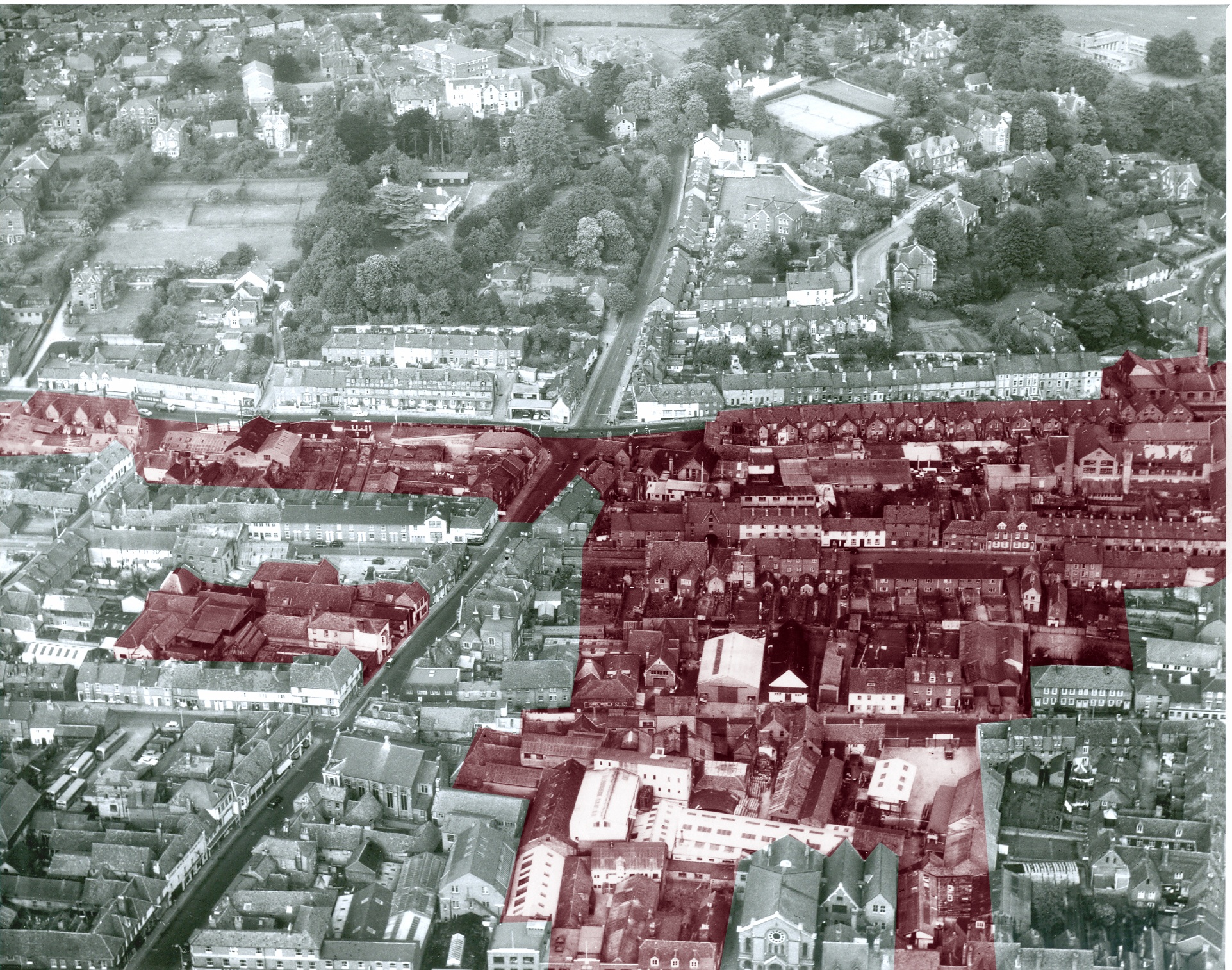
This photo from 1970 shows the layout of part of Salisbury before the construction of the Inner Relief Road. The shaded area in the second photo shows the buildings that were destroyed for the construction of the new road, as well as the notorious “road to nowhere”. This was intended to go straight into the centre of town but remained half finished for many years. It is now the site of Culver Street car stack. When the photo was taken many of the properties had already been emptied ready for demolition.
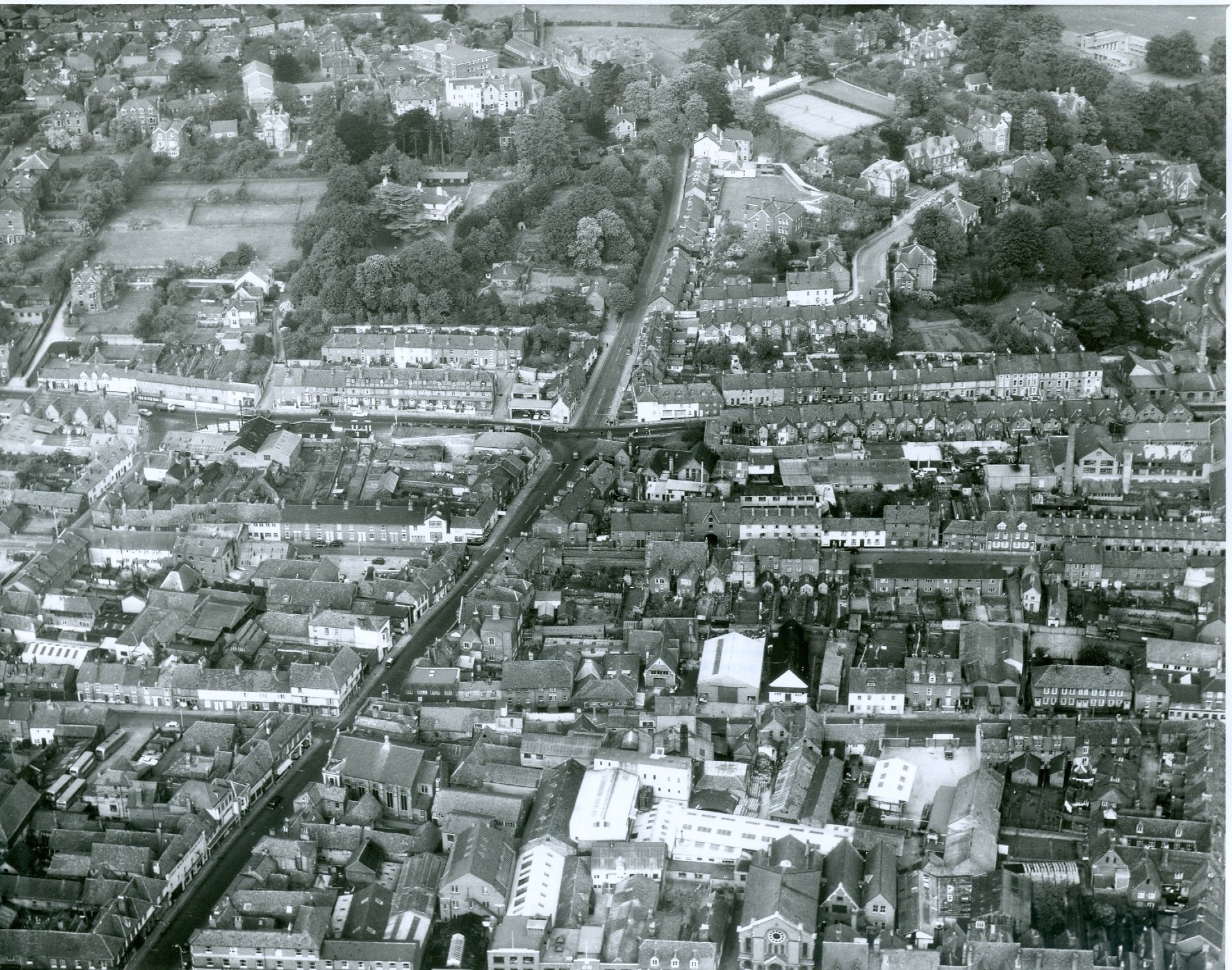
Aerial Photos of Salisbury "Before the Bridge".
Aerial Photograph of the Milford Street Area taken by Aerofilms & Aero Pictorial Ltd, 1970. With kind permission of Wiltshire Heritage Museum
Wiltshire Heritage Museum
Aerial Photograph, Milford Street Area taken by Aerofilms & Aero Pictorial Ltd, 1970, shaded part indicates buildings now lost. With kind permission of Wiltshire Heritage Museum
Comments about this page
Fascinating photos. I remember the ring road and bridge to nowhere being built. I do now however, find it truly disturbing that both projects ending up causing so much destruction. The road to nowhere was a ridiculous farce that should never have been approved. And the biggest question for me is, what wasn’t the ring road designed to go around the city, rather than through it?!
Indeed! I wonder if it would get approval were it to be proposed now?
Add a comment about this page