Milford Goods Yard - old map
John Palmer
")

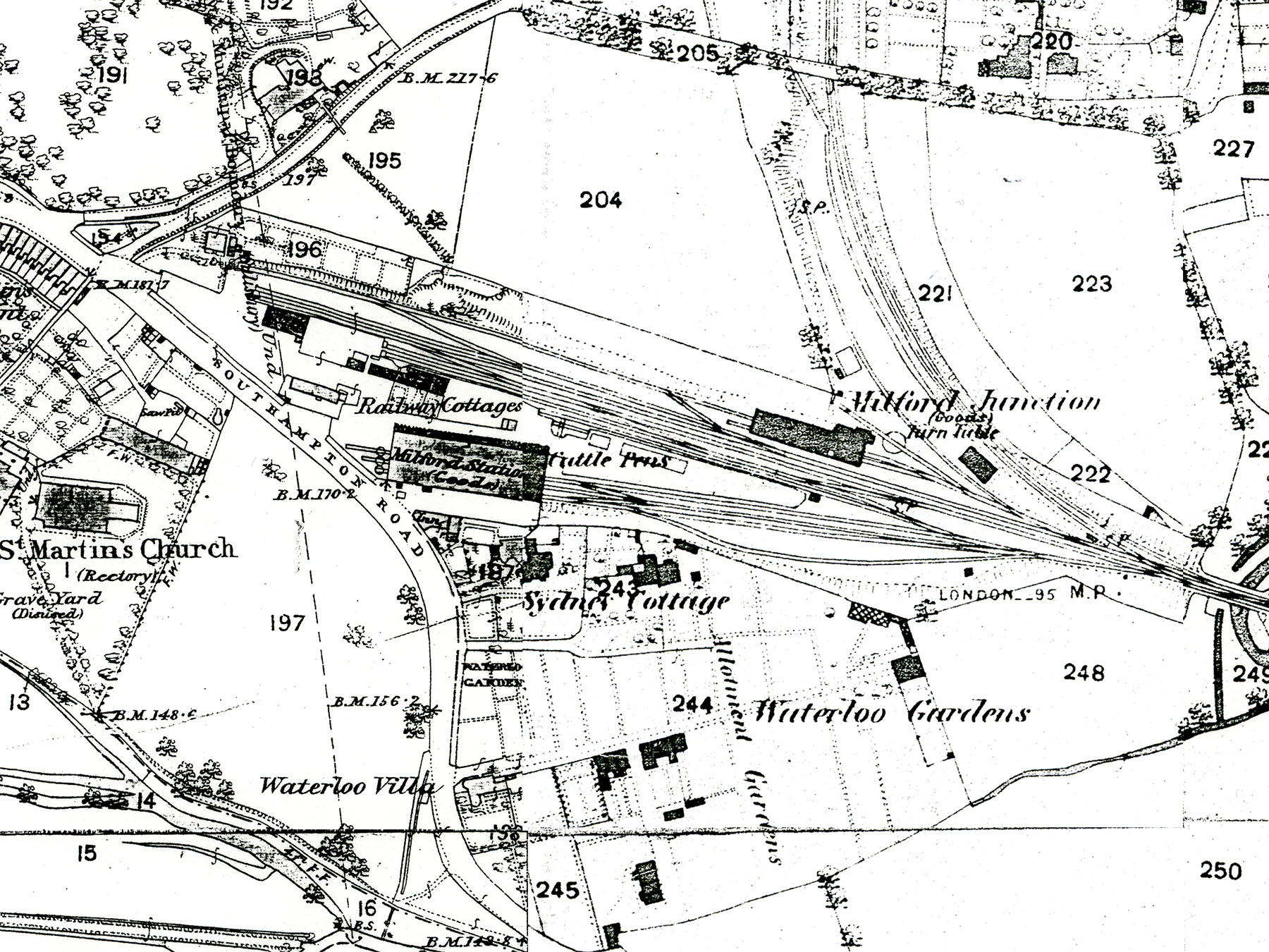
The oldest map I have been able to find showing the Milford Goods Yard and surrounding area is the Ordnance Survey from 1881. Many thanks to Salisbury Reference Library for digging it out. The passenger station at Milford had closed some 20 years previously, in 1859, so this map only shows the goods facilities.
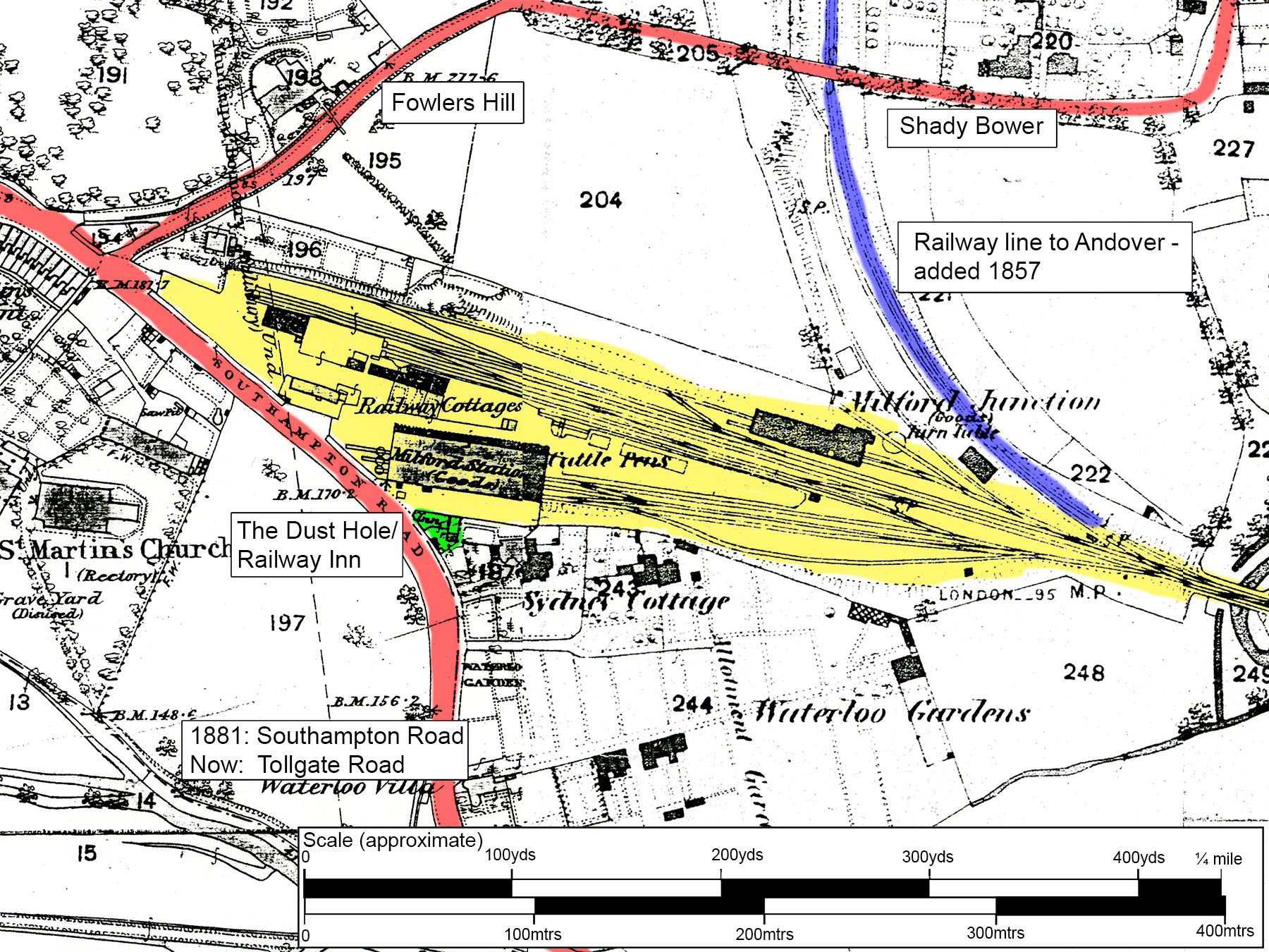
The plain map on the right is a straight copy of the OS map. The annotated version has the goods yard and original railway line highlighted in yellow, to show how large it was. The roads are highlighted in red – they are pretty much the same as today, apart from the change of name of Southampton Road which is now Tollgate Road. The later railway line up the Bourne valley to Andover is shown in blue, it is now the main route between Salisbury and Southampton.
The small green triangle is the Dust Hole/Railway Inn – “the pub with two names”.
For more about the goods yard please see its main page and a gallery of photos then and now.


No Comments
Add a comment about this page